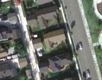
 | | Our house! |
| TerraServer USA, a public-service database of satellite imagery hosted as a joint venture between the U.S. Geological Survey and Microsoft Research, has always been interesting, but since my last visit they've upgraded their imagery and made themselves even more interesting. For many U.S. urban areas, you can now get images in full color at quarter-meter-per-pixel resolution -- four times better than their previous (black and white) 'best' images, and so good that you can zoom in close enough to make out individual people walking around! For example, here's an image of our neighborhood. And here are some other prominent Orange County landmarks: For map geeks, the National Map Viewer is pretty nifty too. |